When navigating in the wild, don’t forget: Your compass doesn’t point true north
Tuesday, July 30, 2019 by Edsel Cook
http://www.bugout.news/2019-07-30-when-navigating-in-the-wild-dont-forget-true-north.html
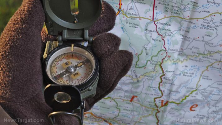
When trying to find your way through the wilderness with a compass, keep one thing in mind: It doesn’t directly point to the “true” north or the magnetic north. A compass is affected by the declination of an area. Preppers and survivalists must keep the variation in mind when navigating in the wild.
The angle between the magnetic north and its geodetic or “true” counterpart, declination is a fickle thing. It shifts depending on the current position of the north magnetic pole, which follows the movement of molten iron deep underground.
Declination may also get influenced by the magnetic fields of metal deposits in a region. No wonder people keep getting lost even after Han China invented the magnetic compass.
Luckily, it takes years for declination to change by a large margin. So a topographical map remains reliable for a few years after its publication.
Also, there are online sites that calculate the magnetic declination of any place in the world. You will benefit from checking the local declination of the area you are going to in case you don’t have a topographical map of it. (Related: Often crucial to survival, the skill of map reading is becoming a lost art.)
How does magnetic declination affect the navigational use of a compass or map?
Every USGS topographical map has a diagram on the lower left. The line with a star points to the true north while the one marked with MN shows the magnetic pole. The angle between the lines indicates the declination.
The magnetic north is labeled with a positive number whenever it appears east of the true north. Conversely, when the magnetic pole shows up on the west side of the geodetic north, it shows a negative number.
Some compasses possess features that take magnetic declination into account during navigation. But most devices do not have that capability. As a prepper or survivalist, you must know how to navigate using needle and degree readings.
In case you don’t have a topographical map, you don’t need to bother with magnetic declination. Assuming there is enough light to see the destination, you may use the compass to determine the heading to that location.
Magnetic declination remains the same whether a person is deciding on a direction or already heading that way. The compass user merely needs to maintain the heading on the compass.
How to read magnetic declination on topographical maps
Things change when you have a topographical map. You may take the heading from the map and use the compass as guidance.
First, determine the heading of the destination using the map. Next, check the magnetic declination of the area. Keep in mind that easterly values are positive numbers while westerly ones are negative.
Subtract the local declination from the map heading. This formula produces the corrected heading.
If the declination is a negative value, remember the math lesson about subtracting negative numbers. Turn the declination value into its positive counterpart and add it to the map heading.
Alternatively, you may use the compass to take the heading of a landmark that you see and look for the location on a map.
In this case, add the declination value to the compass heading. The sum of the two numbers is the corrected heading.
Look for the line on the map that produces the corrected heading. Trace it to find the landmark.
If there is a second landmark present, you can use it to determine your location on the map. Draw a bearing line to the first feature. Repeat this for the second landmark. The intersection point of the two lines indicates your position.
Sources include:
BeansBulletsBandagesAndYou.com
Tagged Under: Tags: basic navigation, bug out, compass, compass reading, geodetic north, magnetic declination, magnetic north, map reading, maps, navigation, off grid, outdoors, preparedness, prepper, prepping, survival skills, topography, true north, wilderness, wilderness skills
RECENT ARTICLES
